|
|
|
|
|
|
| |
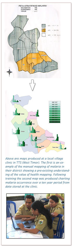
GIS Training in Flores and West Timor
During the first half of November 2008 and March 2009 training was conducted in the use of GIS software for health mapping and field data collection in Soe (TTS) and Bajawa (Flores), Mbai (Flores).
|
|||||||||

|
|
|||||||||||
GIS Training in Flores and West Timor
|
|
|||||||||||